WG100 Maps and Profiles Courtesy Neal Uhlich
Other profiles below.
|
Here are links to route maps. Feel free to print them out and come ride at your leisure. Carroll County is a
great place for bicycling any time of year. You are invited to park your motor vehicle at Perpetual Motion
Bicyces on Maple Street in Carrollton whenever you are cycling here, except on event day for the WG100,
when you should park near the start on the campus.
The [TWENTY FIVE MILE Route] follows the longer routes for the first eight miles or so only then turns off and remains in a bit less hilly terrain.
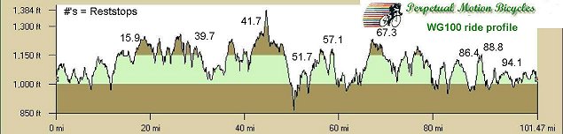
Our [ONE HUNDRED MILE MAP] covers the 50 and 66 mile rides as well as the 100. Here is a pdf map of the [50 mile route] and the [66 mile route]. |
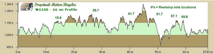
66 mile profile
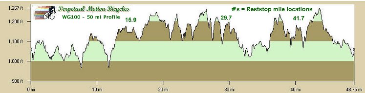
50 mile profile
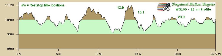
25 mile profile
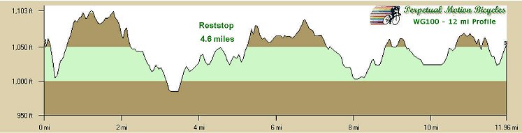
12 mile profile